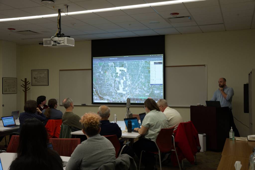
This past GIS Day, November 20th, 2024, we at the Healthy Regions & Policies Lab hosted a “georeference-a-thon,” and created historical map mosaics of Champaign-Urbana in 1915. “Georeferencing” a map means transforming it from a scanned image into a proper geospatial dataset, essentially, overlaying it directly onto a web map of today’s world and allowing it to be integrated with any other spatial data.

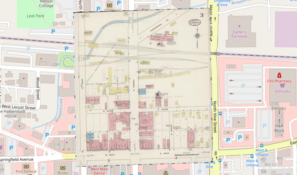
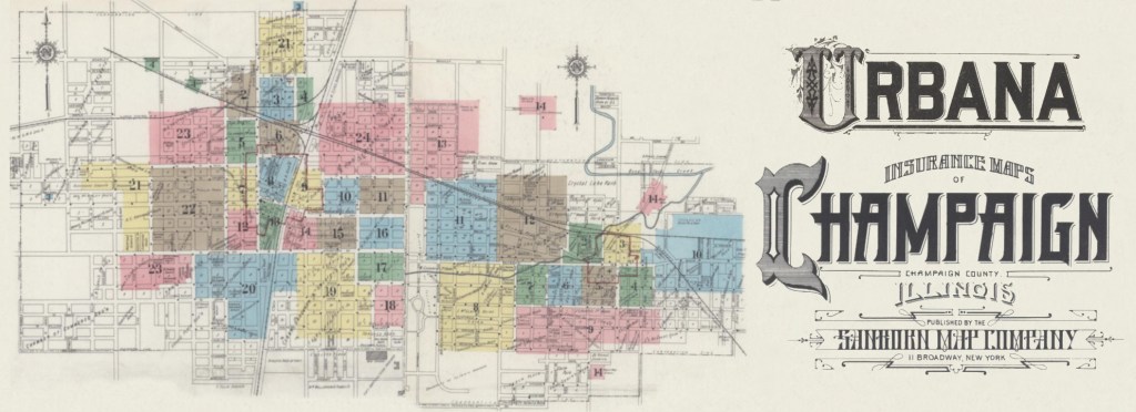
For the event we used the open source platform OldInsuranceMaps.net, a web project created and maintained by one of our engineering staff (Adam Cox), which facilitates this georeferencing process for fire insurance maps created by the Sanborn Map company that are available online from the Library of Congress. These maps were published for many decades around the turn of the 20th century, and they provide an incredible peek into the urban history of the United States. They cover residential and commercial districts in cities and towns across the nation, showing every building in detail–its architectural materials, current use, and anything else a fire insurance underwriter would want to know.

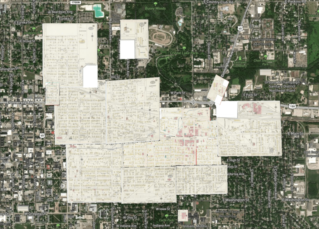
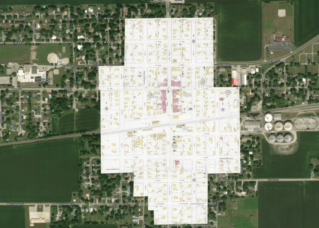
When all pages of a Sanborn Map atlas have been georeferenced, effectively “stitching” them together, they form a seamless mosaic that reveals a comprehensive fabric of how these cities looked over 100 years ago.
The UIUC Event
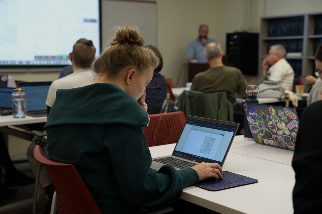
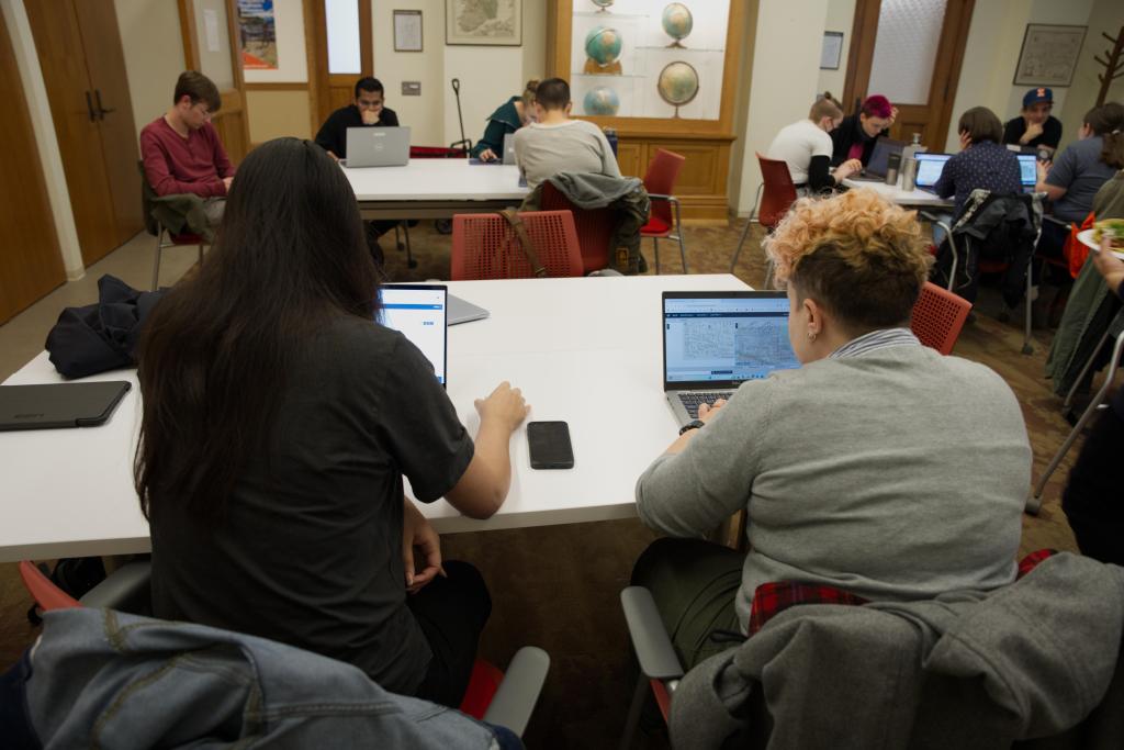
For our GIS Day event, we posted flyers and gathered over 20 people in the Russell Room of the Natural History Building, to spend two hours georeferencing maps of—where else?—Champaign and Urbana in 1915. We had people from many different parts of campus join, and even some community members from outside the university.

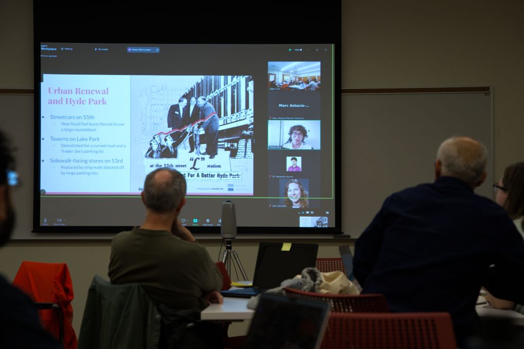
We also had two guest speakers present during the event over Zoom. First, Parker E-K Otto, the inaugural Herbert Zar Post-Baccalaureate GIS Fellow at the University of Chicago, joined to give an overview of his independent research initiative, “The Roaring ’20s Chicago Project.” Parker’s work uses georeferenced Sanborn maps as a foundational data source by extracting geospatial and historical content from the images to recreate the residential and commercial layout of the city. It was a pleasure to learn about this effort, and exciting for participants in our event to see real-world research applications of georeferenced Sanborn maps, even as they were georeferencing maps themselves!
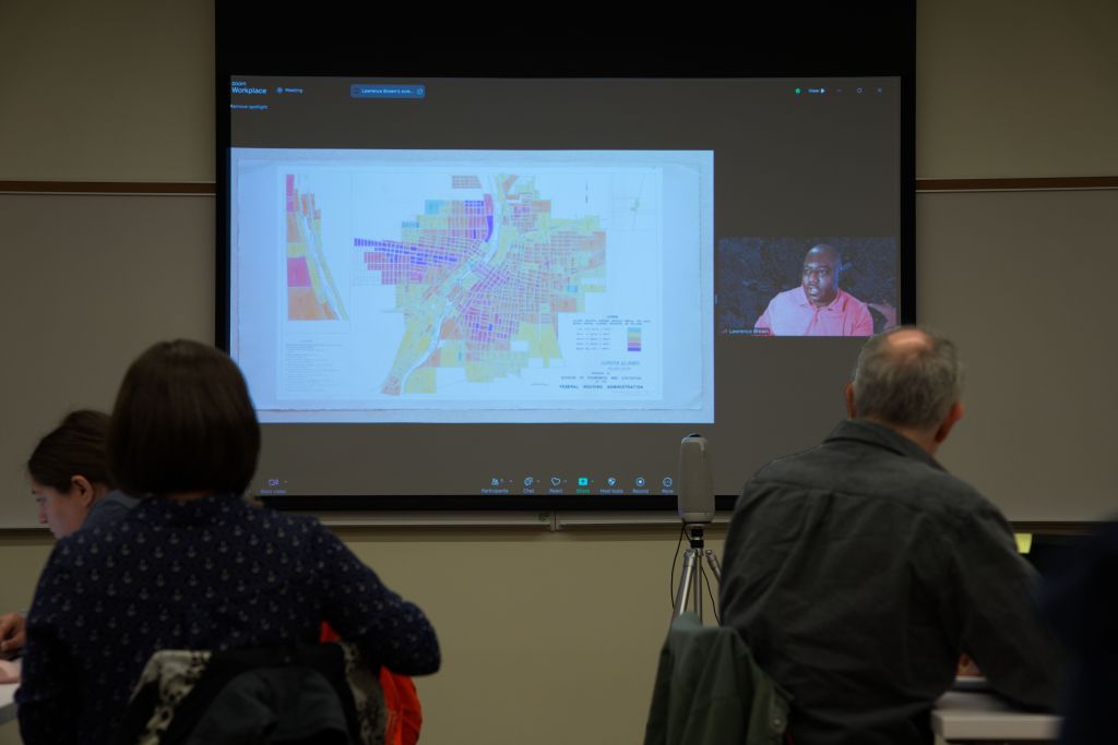
Second, we were honored to have a presentation by Dr. Lawrence Brown from the Center for Urban Health Equality at Morgan State University, and author of The Black Butterfly: The Harmful Politics of Race and Space In America. Dr. Brown and his students have begun georeferencing a different set of historical documents, Federal Housing Administration (FHA) Block Data maps from the late 1930’s and 1940’s. These maps were ostensibly created to track residential economics for every block across dozens of U.S. cities, but they also record non-white racial demographics, explicitly creating tools that were used by insurers and residential real estate developers to further marginalize those demographic groups.
The Results
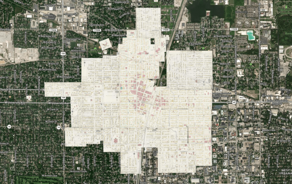
After two hours we had completed the entire set of maps for both Champaign 1915 (24 original sheets) and Urbana 1915 (14 original sheets), and someone even worked on Homer!
Here’s how you can explore the work we did, or download the GeoTIFFs to use in your own research:
- Full map views for exploration:
- Overviews of all work on each individual edition, including download links for each page:
- Urbana 1915: https://oldinsurancemaps.net/map/sanborn02194_006
- Champaign 1915: https://oldinsurancemaps.net/map/sanborn01778_006
- Homer 1909: https://oldinsurancemaps.net/map/sanborn01929_003
- See the Summary section for a full list of all georeferencing actions by participants!
Please note as you explore: We can’t guarantee the accuracy of these old maps, nor how well they have been georeferenced. But you’ll soon see, there is a lot of rich historical information to be found in them!
In collaboration with others…
Later in the afternoon of the 20th, we also joined with the University of Chicago libraries to host a similar “georeference-a-thon”, focusing instead on Sanborn maps on the Southside of Chicago. You can see an overview of our work from that event on Chicago, 1895, Volume 6a, or explore all Chicago maps in the main viewer. (Another team, at the University of Richmond has been working on all of the 1950s Chicago maps for an entirely different project, and you can see them in the main viewer as well.)
The following day, we continued georeferencing on OldInsuranceMaps.net, this time with Dr. Kolak’s Population Geography class (GGIS 384), in collaboration with Dr. Brown’s lab at Morgan State University. During this multi-site event, students worked not on Sanborn maps, but the FHA Block Data maps mentioned above. There will be much more to say about that work as it progresses this Spring, so stay tuned!

Leave a comment